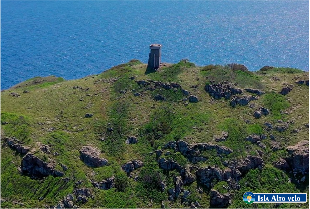
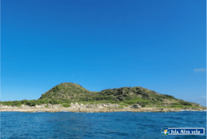
High Veil Island is a small island that is part of the Jaragua National Park and is located in the southernmost point of the country, corresponding to one of the peaks of the so-called Beata Submarine Cordillera, reaching a height of 152 meters above sea level. sea. It is a small adjacent island of the Dominican Republic located in the southwest of the country, in the Pedernales province, and 7 miles from Beata Island. It has an area of 1.02 km²,1 it is the southernmost part of the country.
It is a little tourist destination, uninhabited and difficult to access, with rocky coasts and arid landscapes, whose main attraction is its rich avifauna ecosystems, among which are the largest breeding colony of seagulls in the country.
Alto Velo Island, like Isla Beata and Los Frailes islet, was discovered by the great Admiral Christopher Columbus, during his second voyage. It was Christopher Columbus who gave it that name, due to its majestic silhouette that can be seen from great distances from the sea.
There are several theories about the origin of the name, according to some historians, the name Alto Velo is due to the fact that on full moon nights it resembles a ghost, according to others, it is due to the fact that from the sea the pointed, triangular and elevated shape of the island resembles the sail of a ship, and hence its name.
It is also said, according to the history of the Alto Velo Island, that Bartolomé de las Casas, when writing the Very Brief Account of the Destruction of the Indies, designated it with the name of Alta Vela, which later caused confusion, since it did not it was known what to call it, if Alto Velo or Alta Vela.
The small island began to appear on almost all French navigation charts from the 17th century and on Italian ones. Immediately, the island became a great orientation route for ships, both Spanish and French, sailing to Haiti, Cuba and all the Caribbean Islands.
Alto Velo Island was populated by Haitians from the 16th century, and during the Haitian Domination 1822-1844, the Haitians had passed it to their territory. But it is not until 1854, when a group of North American adventurers force them to leave the island, and the latter remaining on it, they begin to exploit the large deposits of guano that it possessed and in the highest part of Alto Velo, they placed the flag from United States.
The trade winds that pass through the island from East to West play a very important role on the vegetation of the western part of the island, where the trees suffer the effects of the wind and are crushed.
Also, the western part is the area where the largest number of seagulls and boobies nest. It should be noted that these birds come from different parts of the Antilles and leave an extraordinary amount of droppings “(Guano)”, which, as time goes by, forms a thick layer on the sand and rock.
To find out about other interesting places in the Dominican Republic, follow us at visitadominicana.com
How to get to High Veil Island: CLICK HERE!