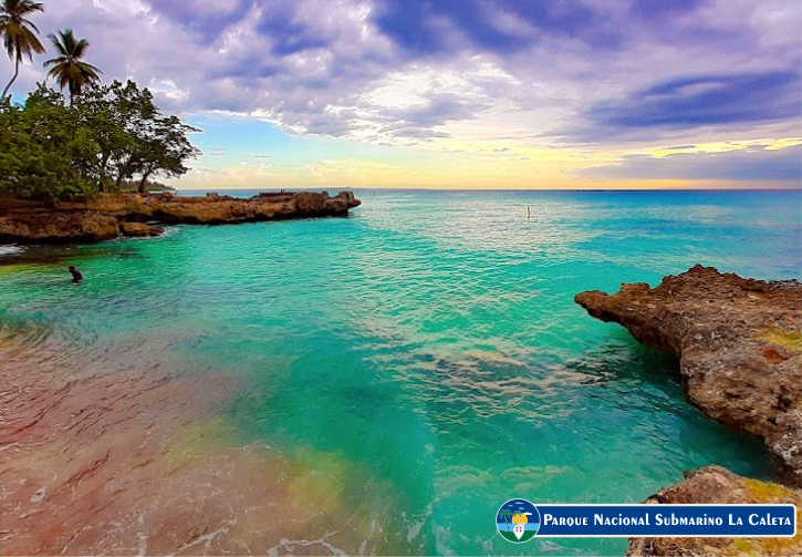
La Caleta National Underwater Park, one of the first in the region, is a popular dive site located near Santo Domingo. It is known for its many shipwrecks, but also for its abundant marine life ready to be explored by divers of all levels, from beginners to advanced.
It is located 20 km. to the east of the city of Santo Domingo, in front of Las Américas International Airport near the town of La Caleta. It is a protected bay with shallow waters. Its western limit begins in the cave of Las Golondrinas, to the south is the isobathic line of 100 fathoms deep until reaching the southwestern end of Punta Caucedo. Considered by experts as one of the best diving spots in the country.
The depths range from six to 180 meters, in an area of 10 km² from the Cueva de las Golondrinas to Punta Caucedo. The irregular topography of La Caleta includes three defined terraces, underwater caves and well-known shipwrecks. A variety of corals and schools of colorful creatures thrive here, using the reefs for shelter and a food source, including groupers, puffer fish, rays, lionfish, octopuses and turtles.
Among the most popular wrecks is the Hickory, a 1984 ship located about 18 meters deep, sunk in 1984 by a group of underwater researchers to create an artificial reef for the proliferation of marine life. Other wrecks include the El Limón and Capitan Alsina, located about 30 meters deep, and the Don Quico at about 58 meters deep.
Nearby, an impressive system of karst rocks creates a meandering network of caverns and underwater tunnels over 100 meters long, an ideal place for technical diving. It has an extension of about 12 km², and an approximate depth of 20 feet of sandy bottom.
The main attraction of this protected area is the variety of sunken artificial structures to encourage diving, such as the “Hickory”, a ship sunk expressly in 1984 by the Underwater Research Group (GIS), with the aim of creating an artificial reef. promote the proliferation of marine life. In addition, in the background, two other ships coexist with it that it is also possible to explore, the “Capitán Alsina” and “El Limón”.
You can also visit an underwater trail of sculptures that explain the Taino culture in La Caleta. To get there by sea, the coordinates to get to Caleta beach are: 18°26’52.01″N, 69°41’4.69″W.
To find out about other interesting places in the Dominican Republic, follow us at visitadominicana.com
How to get to La Caleta Underwater National Park: CLICK HERE!
